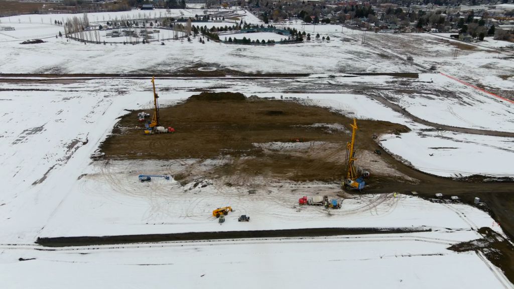
Drone Construction Monitoring in Lubbock and West Texas
Ensure your project stays on track with our drone construction monitoring services in Lubbock and the surrounding region.
Progress Tracking
Efficient and Reliable Aerial Site Monitoring
Efficiently manage your West Texas projects with our advanced drone services. We provide real-time data and high-resolution visuals to keep you informed throughout every stage of your project. From tracking progress to identifying potential issues, our technology helps you stay on schedule and maintain clear communication with your team and stakeholders.
Acreage Properties
Orthomosaics for Large-Scale Construction Site Monitoring
Orthomosaic images are an invaluable tool for construction monitoring, especially for large-acreage sites across the South Plains. Vantage Drone creates these high-resolution, georeferenced maps by stitching together hundreds of aerial photos, resulting in a seamless, detailed image of your entire property. For large construction projects, rural Texas agricultural fields, or expansive earthwork sites, orthomosaics provide a complete and accurate view of your land. These maps make it easy to track progress, monitor changes in terrain or erosion, and ensure large-scale projects remain on schedule. With clear, up-to-date visuals covering every inch of your acreage, you can better manage your site, address potential issues early, and confidently make decisions.
Advanced Tech
3D Models and Topographic Data for Accurate Planning
Our 3D models and topographic data offer unparalleled precision for construction monitoring and planning. These models provide a detailed representation of your site, capturing terrain features and elevation changes with high accuracy. Vantage Drone delivers geospatial data that integrates directly into engineering and architectural software, streamlining workflows and improving collaboration. By visualizing your site in 3D, you can identify challenges early, optimize project planning, and make data-driven decisions that keep your project running smoothly. Whether you’re managing large-scale construction or planning infrastructure, our tools ensure you stay informed and prepared.
High Resolution
Drone Construction Monitoring with Photos, Videos, and Time-lapses
Vantage Drone captures high-resolution images and videos to keep you updated on your construction site’s progress. From top-down progress photos to immersive videos and dynamic timelapse footage, we provide visuals that showcase the evolution of your project. These high-quality visuals are perfect for documenting milestones, presenting updates to stakeholders, or creating compelling marketing content. By using our construction monitoring services, you gain clear and actionable insights into on-site activities, helping you make informed decisions and maintain project momentum.
Why Choose Vantage for Drone Construction Monitoring?
Our advanced drone technology delivers fast, cost-effective construction monitoring with unmatched accuracy and reliability. Clear visuals and actionable insights keep you in control and help you achieve your project goals efficiently. Contact us to see how our services can elevate your operations across the South Plains.
Projects
Check Out Our Work


