3D Mapping and Drone Land Survey in Lubbock
Gain precision and insight with our drone land survey services in Lubbock and the South Plains. We use advanced 3D mapping technology to deliver reliable data for every stage of your project.
Aerial Survey
Accurate and Efficient Drone Land Surveying in Lubbock
Our drone land survey services help you assess properties with clarity and accuracy. We generate high-resolution site maps, geo-referenced models, and elevation data tailored to your project scope. Whether you’re developing land, planning construction, or managing infrastructure, our technology ensures you have the tools to move forward efficiently.

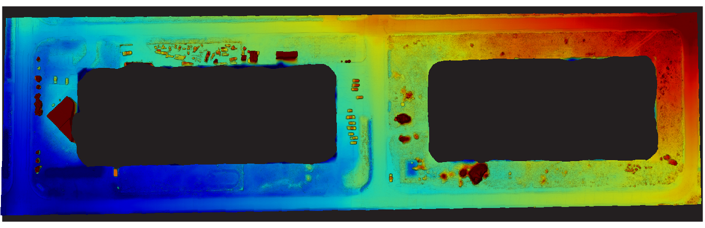
Accurate Elevation Data with Digital Drone Land Surveying
We create Digital Elevation Models (DEMs) that highlight terrain changes across your property. These detailed visuals help you measure slopes, plan drainage, and evaluate site readiness for construction. With early terrain insights, you can address challenges before they impact your timeline or budget.
Visualize Terrain with Topographic Mapping
Topographic drone mapping captures terrain shape through precise contour lines. This allows you to evaluate slopes, gradients, and boundaries—ideal for construction prep, grading plans, and land assessments. Unlike broader elevation maps, our topographic surveys provide the accuracy required for smart planning.

Orthomosaic Mapping for Large Properties
Our orthomosaic drone maps stitch together hundreds of high-resolution, geo-referenced images into a single, accurate visual of your land. These maps are especially useful for large acreage, providing a comprehensive view for layout planning, zoning, or boundary evaluation.

Geo-Referenced Drone Mapping and Point Clouds for Precise Planning
Using our high-tech drone, we create accurate geo-referenced maps and point clouds that seamlessly integrate with popular engineering and architectural software, ensuring your survey data aligns perfectly with existing plans. Point clouds provide a detailed 3D representation of your property, allowing you to visualize terrain, calculate measurements, and present data to stakeholders in an engaging and clear format. This compatibility streamlines workflows, saves time, and enables confident decision-making throughout your project.
